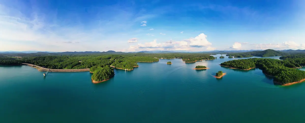
Look out at Lake Nottely in late fall and the water can sit well below a wide band of bare bank under the tree line. Nothing is wrong. Lake Nottely is a Tennessee Valley Authority reservoir, and the low water is part of how TVA runs it.
The short version: flood storage
TVA’s Nottely lake information page says that in a year with normal rainfall, the water level “varies about 20 feet from summer to winter to provide seasonal flood storage.” The reservoir has 61,600 acre-feet of flood-storage capacity. An acre-foot is enough water to cover one acre a foot deep, so that is a lot of empty space held in reserve for heavy rain.
TVA’s general target is to have its tributary reservoirs back up to summer level by June 1, but rainfall decides how close any given year gets. For the day you’re visiting, the lake information page links to TVA’s daily reservoir operation data.
The lake by TVA’s numbers
| Item | TVA figure |
|---|---|
| Water surface | 3,970 acres |
| Shoreline | 102 miles |
| Length | About 20 miles |
| Flood storage | 61,600 acre-feet |
| Normal summer-to-winter swing | About 20 feet |
| Hydropower | One unit, 18 megawatts, in commercial operation since 1956 |
Many travel guides repeat 4,180 acres and 106 miles of shoreline. TVA’s own reservoir facts gives 3,970 acres and 102 miles, and those are the figures used here. TVA also notes that much of the shoreline is national forest.
A wartime dam
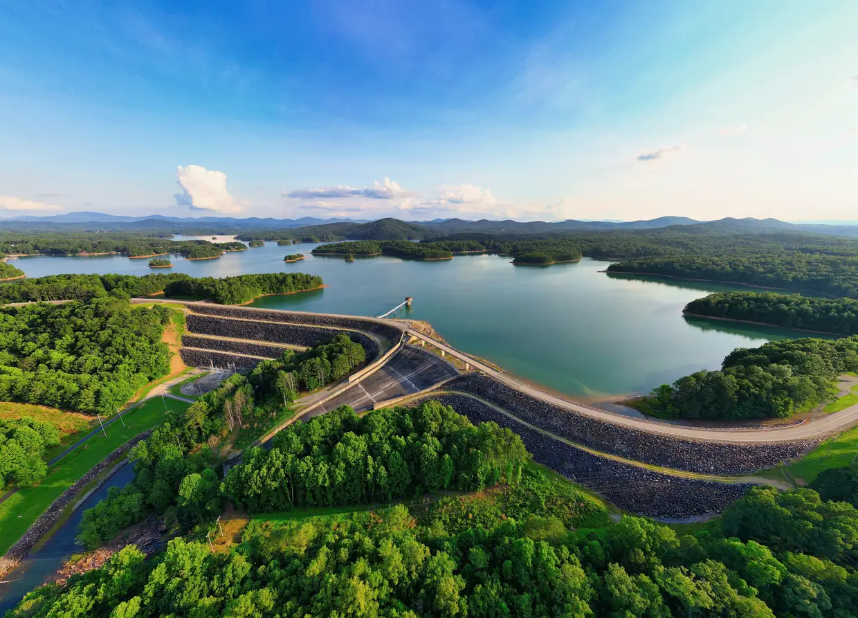
TVA built Nottely Dam during World War II. Construction began July 17, 1941, the gates closed January 24, 1942, and the dam was finished that year, according to TVA’s history article “The Quiet Beauty of Nottely”. Building it meant buying almost 8,000 acres and relocating 91 families. The single hydroelectric unit came later and began commercial operation in 1956. TVA’s two Nottely pages give different dam dimensions, so they’re left out here.
What the drawdown means for a visit
- Expect more shoreline than water. Summer photos of the lake won’t match what you see from late fall through winter. The bare banks are normal for the season.
- Check the ramp before you tow. A ramp that reaches deep water in summer can end in shallow water or mud when the lake is down 20 feet. Look at TVA’s current level first, and if possible look at the ramp before you back a trailer down it.
- Poteete Creek is seasonal. Union County’s Poteete Creek Campground at 1040 Poteete Creek Road has 88 sites, a boat ramp, a swimming beach, a pavilion and a bathhouse, with $5-per-car day-use parking for the ramp and beach. The county lists its season as April 1 through October 15, so the 2026 season has just ended.
- Walk the dam trail instead. TVA describes the Nottely Dam Trail as a figure-8 of about two miles at a steady grade, mostly in the woods with stretches near the shore. TVA’s land management page lists a 2.6-mile trail, so call it two to 2.6 miles. The dam is about 11 miles northwest of the square by US 19/129 north and GA 325 (Nottely Dam Road), roughly 15 minutes with no traffic by a free routing estimate.
Our Lake Nottely guide covers where to go on the water when it’s up, and things to do has more for a fall day.
If you’re looking at a lake lot or a dock
The 20-foot swing matters most to anyone shopping for lakefront. The water’s edge below a lot in July can be noticeably farther away in January, and a dock has to work at both levels. A few checks before you buy:
- See the shoreline in person at winter levels, not only in summer photos or listing pictures.
- Use TVA’s Nottely lake information page to see where the lake stands on the day you visit.
- Ask TVA about its shoreline rules for docks and other construction before planning anything at the water’s edge. Much of the shoreline is national forest, and TVA’s land management plan counts 828.6 acres of TVA public land around the reservoir, in 42 parcels.
For the bigger picture on day-to-day life here, see living in Blairsville.
Questions people ask
Why is Lake Nottely so low in the fall?
TVA lowers it on purpose. In a year with normal rainfall, Nottely's water level varies about 20 feet between summer and winter to provide seasonal flood storage, and the reservoir can hold 61,600 acre-feet of floodwater.
Source: TVA lakeinfo – Nottely Reservoir
How big is Lake Nottely?
TVA lists 3,970 surface acres and 102 miles of shoreline, and describes the reservoir as about 20 miles long. Many guides repeat 4,180 acres and 106 miles, but TVA's own reservoir facts give the smaller figures.
When was Nottely Dam built?
TVA began construction on July 17, 1941, closed the gates on January 24, 1942, and finished the dam in 1942. Its one hydroelectric unit, rated at 18 megawatts, began commercial operation in 1956.
Is Poteete Creek Campground open in the fall?
Union County lists Poteete Creek Campground's season as April 1 through October 15. The recreation area on Lake Nottely has a boat ramp, swimming beach and bathhouse, and day-use parking for the ramp and beach is $5 per car.
Written by the Downtown Blairsville Editorial Team. AI tools help us draft; people check every fact before it publishes.
Dates, hours and fees change. For anything official, the city has the final word: City of Blairsville official site