Which mountain day fits you?
Five quick questions. You get one pick and two backups, with drive, fee and trail facts from the Forest Service, Georgia State Parks and TVA.
The outings it chooses from
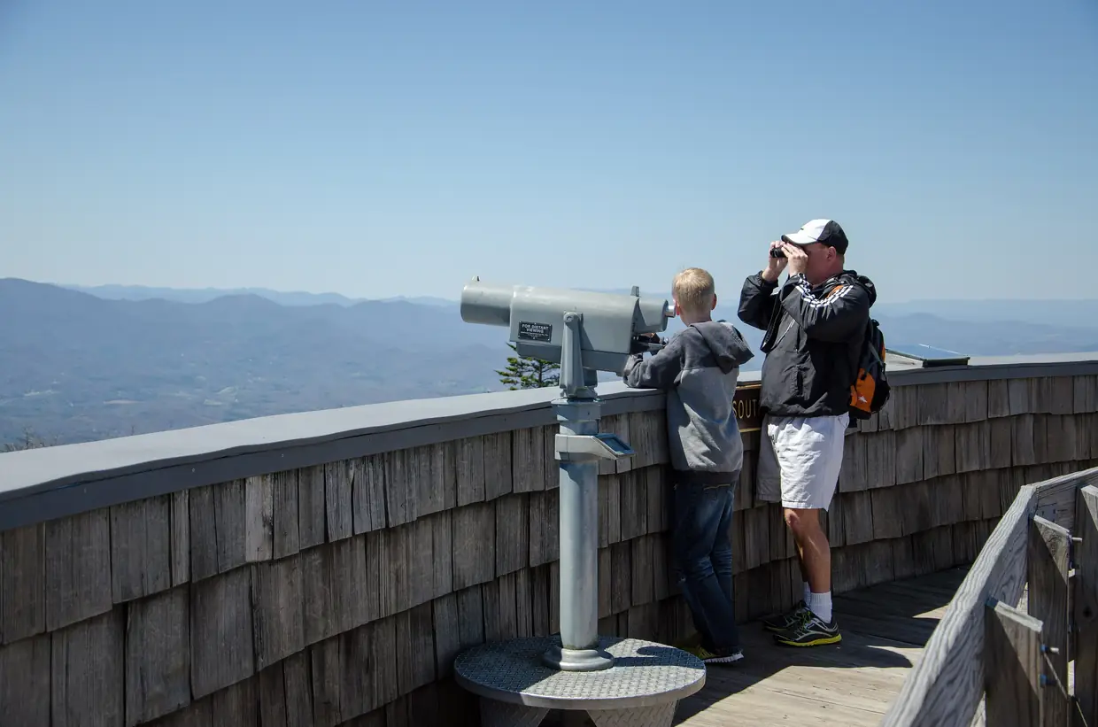
- Brasstown Bald summit: Georgia's highest point at 4,784 feet, with a 360-degree view from the summit observation deck.
- Helton Creek Falls: A short Forest Service walk to a waterfall and observation deck.
- Sosebee Cove Scenic Area: A 175-acre high-elevation cove forest of very large yellow poplars and buckeyes, best known for spring wildflowers.
- Blood Mountain from the Byron Reece trailhead: The highest point on the Appalachian Trail in Georgia, at 4,461 feet, inside the Blood Mountain Wilderness.
- Neel Gap and the Walasi-Yi Center: The 1930s CCC stone building where the Appalachian Trail passes through a breezeway, now home to the Mountain Crossings outfitter.
- Vogel State Park: Georgia's second-oldest state park (1931), built largely by the Civilian Conservation Corps.
Closed or changed right now
- Vogel State Park: Lake Trahlyta at Vogel State Park covers 22 acres. As of October 2026 the park reports the lake is drained for dam repairs and maintenance, and the Lake Trahlyta Loop Trail and Trahlyta Falls are closed. (Georgia State Parks)
- Track Rock petroglyphs: As of the Forest Service’s August 2026 update, the Track Rock petroglyph site is temporarily closed. The Arquaqua Trail parking lot and trailhead nearby remain open. (U.S. Forest Service)
- Lake Winfield Scott: Lake Winfield Scott Recreation Area surrounds an 18-acre mountain lake and offers camping, picnicking, boating, fishing, swimming and hiking. As of September 2026, the campground, beach and picnic pavilion are closed until further notice for construction and maintenance, but the fishing pier off GA 180 is open. (U.S. Forest Service)
About an hour
- Helton Creek Falls: a free 0.2-mile Forest Service walk to a waterfall deck, about 13 miles south (USFS).
- Sosebee Cove: a short loop through a 175-acre cove of very large trees, free and open all year (USFS).
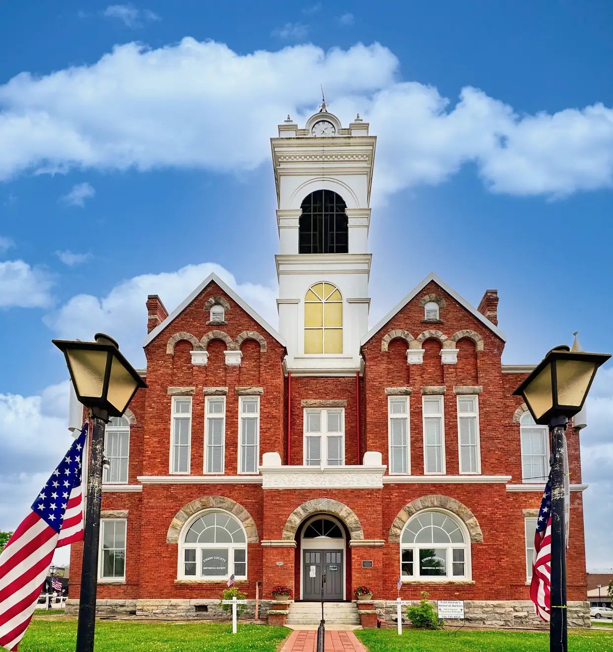
- The Old Courthouse Museum: free, on the square, weekdays 10 to 4 and Saturdays 11 to 3 from May through December (Historical Society).
Two to three hours
- Brasstown Bald: Georgia’s highest point, 4,784 feet, about 20 miles away; visitor center 10 to 5 daily, $10 per adult (USFS).
- Nottely Dam and its trail: TVA describes a figure-8 trail of about two miles through the woods and along the shore (TVA).
- Neel Gap: the 1930s stone building where the Appalachian Trail passes through a breezeway (Mountain Crossings).
Half a day or more
- Blood Mountain: 4,461 feet, the highest point on the Appalachian Trail in Georgia (ATC), climbed from the Byron Reece trailhead.
- Bear Hair Gap at Vogel: a moderate 4.1-mile loop of about two hours over the lower ridges of Blood Mountain (Georgia State Parks).
Cloudy or rainy day
When the summits are in cloud, the view from Brasstown Bald is gone, so stay low: the two Historical Society museums in town, the waterfall walks (which can be better after rain), and the Mountain Crossings store at Neel Gap. Our journal has the cloudy-day rule in full.
- 1,890 ftThe courthouse squareStart here · USGS point value at the square
- 2,500 ftVogel State Parkabout 11 mi south · Georgia State Parks: about 2,500 ft
- 4,461 ftBlood Mountainabout 13 mi south, then a hike · Highest point on Georgia's A.T.
- 4,784 ftBrasstown Baldabout 20 mi · Highest point in Georgia
Feet above sea level. Sources: USGS, Georgia State Parks, Appalachian Trail Conservancy, U.S. Forest Service. These places sit in different directions from town, so the line ranks them by height, not by road.
Questions people ask
Is Lake Trahlyta at Vogel State Park open?
Not right now. Georgia State Parks says the lake is drained for dam repairs and maintenance, and the Lake Trahlyta Loop Trail and Trahlyta Falls are closed. No reopening date has been given.
Source: Georgia State Parks
How much does Brasstown Bald cost?
The Forest Service's page lists $10 per adult (16 and over) during open hours, free for children 15 and under, and $6 after hours. Some older pages still say $8.
Source: U.S. Forest Service
How long is the walk to the top of Brasstown Bald?
The paved foot trail from the parking lot to the summit is 0.6 mile, and the Forest Service describes it as very steep.
Source: U.S. Forest Service
Does the Appalachian Trail go through a building at Neel Gap?
Yes. The trail passes through the breezeway of the stone Walasi-Yi Center, built by the CCC in the 1930s and now home to the Mountain Crossings outfitter.
Source: Mountain Crossings
How long is the Helton Creek Falls trail?
It's an easy 0.2-mile walk with abrupt changes in grade, ending at an observation deck. It's free and open all year, with no restrooms or water.
Source: U.S. Forest Service
Are the Track Rock petroglyphs open?
Not at the moment. The Forest Service's August 2026 update lists the petroglyph site as temporarily closed; the nearby Arquaqua Trail parking lot (as the Forest Service spells it) and trailhead remain open.
Source: U.S. Forest Service
Dates, hours and fees change. For anything official, the city has the final word: City of Blairsville official site